
Thursday, 2 October 2014
Geodesea Ltd provide personnel for Wind Farm Cable Route Survey
Geodesea Ltd have recently been sub-contracted by the Port of London to provided qualified Hydrographic personnel for a high resolution cable route survey for GME Offshore on behalf of DONG Energy. Max Fisher was the nominated Hydrographic Surveyor for all data acquisition, processing & rendering for this project located in the southern North Sea..
Thursday, 13 March 2014
High Resolution Surveys for Transport for London / London Underground
Geodesea Ltd has recently been contracted by the PLA to acquire, process and render high resolution surveys of the numerous tunnel crossings under the River Thames for Transport for London & London Underground.
POSMV INS and Reson MBES survey data was acquired using Hypack/Hysweep and processed using Hypack/Hysweep & Fledermaus software.
These surveys assist in the ongoing monitoring for scour and accretion of the river bed in the vicinity of the tunnels.


POSMV INS and Reson MBES survey data was acquired using Hypack/Hysweep and processed using Hypack/Hysweep & Fledermaus software.
These surveys assist in the ongoing monitoring for scour and accretion of the river bed in the vicinity of the tunnels.
Thursday, 26 December 2013
TTT Bathymetric Monitoring Surveys
Geodesea Ltd have recently been contracted by the Port of London Authority (PLA) to provide specialist hydrographic services for bathymetric monitoring surveys of the River Thames in support of the Thames Tideway Tunnel.
This is a tight tolerance MBES & intertidal foreshore laser survey of a 23km stretch of the river thames.

More information on this massive engineering project can be found at www.thamestidewaytunnel.co.uk
This is a tight tolerance MBES & intertidal foreshore laser survey of a 23km stretch of the river thames.

More information on this massive engineering project can be found at www.thamestidewaytunnel.co.uk
Saturday, 12 October 2013
Royal Docks, London
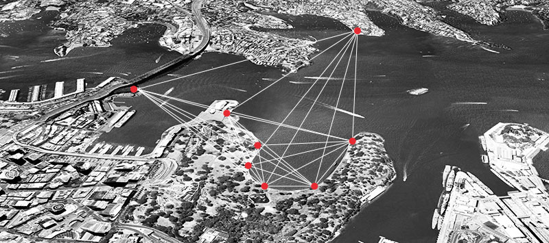
Geodesea Ltd were sub-contracted by the Port of London Authority in August to carry out a survey of the Royal Victoria Dock for Royal Docks Management Authority. Below are some images of the Connaught Cut, Royal Victoria Dock.


Sunday, 23 June 2013
Return to UK
Please note new contact details since relocating back to the UK after an excellent 3yrs operating in Australia.
t: +44 (0)7743 146780
t: +44 (0)7743 146780
Sunday, 19 May 2013

Sunday, 21 April 2013
Strip The City for Discovery Channel by Windfall Films
Just found this on the web - using our MBES data and some 3D visualisations we rendered for them - unfortunately we were away with the 7125 during the filming and the SBES was on display for the film crew... ha ha such is life!
Monday, 11 March 2013
Bathy Berth Box Profiler
A recent project has been the development of a berth box profiler for Sydney Ports Corp.
Often it is difficult to quickly highlight shoal spot depths within a berth box on a conventional bathymetry chart, especially small scale charts densely populated with soundings. It is generally the shoalest depth and its realtive location (chainage) along a wharf which is of importance rather than its absolute position in real world coordinates. This is especially true when under-keel clearance is an issue and dictates where along a wharf a vessel may be berthed.
Hence the new executable app. It will take high resolution XYZ ascii data from within a berth box and "snap" to fender line, and output a re-projected dataset showing Chainage, Depth and (if required) perpendicular distance to fender line.
Capable of handling larger data sets than CivilCAD, and without the crashing ;-)


Wednesday, 20 February 2013
New CARIS SVP importer
Amazingly CARIS HIPS/SIPS has never included a GUI data parser for importing raw SVP data into HIPS. Programmatically quite simple, all online hydrographic acquisition software packages and most other data processing packages have this facility.
Anyone using MBES data, therefore, always has to go through the painstaking task of butchering the files in text editors or write their own macros in order to get the data to fit the CARIS format. Frustrating - I know from experience - especially on jobs where SVP changes frequently both temporally and spatially, with hundreds of SVPs needing conversion. Annoying, especially as all metadata (bar the position) is usually logged in the raw file headers.
Hence my app - the CARIS SVP Importer. If you need an importer for your SVP model, let me know and I may be able to help :-)


Sunday, 10 February 2013
Bathymetric Marine Information Overlays (bMIOs) at SPC
I have recently been working on using bMIO outputs from CARIS into QPS Qastor for use by Sydney Ports Pilots.
bMIOs show chart and navigation-related information that
supplements the minimum information required by
the IMO ECDIS. These will be used to display the latest soundings and contours on top of the existing AusCharts.

bMIOs show chart and navigation-related information that
supplements the minimum information required by
the IMO ECDIS. These will be used to display the latest soundings and contours on top of the existing AusCharts.

Sunday, 6 January 2013
SPC Aids Locata Sydney Satellites Project
Sydney Ports Corp recently aided Locata Corp & University NSW with the city trials of Locata ground-based positioning system installed onboard SV Port Explorer.

Sunday, 16 December 2012

Tuesday, 20 November 2012
Yamba Full Survey Completed
The Clarence River / Yamba Port full survey was completed in October. All went well and data looks great!


Monday, 8 October 2012
Strip The City
Recent works have involved the processing of high-resolution multibeam sonar data of Sydney Harbour, and its wrecks contained within, and the rendering of high-resolution animations for Windfall Films "Strip the City" series, soon to be aired on the Discovery Channel.


For more information: http://www.windfallfilms.com/show/2449/harbour-city-sydney.aspx


For more information: http://www.windfallfilms.com/show/2449/harbour-city-sydney.aspx
Thursday, 27 September 2012
New Survey Vessel "Port Explorer" launched!
The long awaited arrival of SPC's new survey vessel "Port Explorer" was launched last Friday.
We are now in the process of kitting out the SV Port Explorer with a moon pool mounted Reson 7125SV multibeam sonar and Applanix POSMV 320 inertial navigation system.


We are now in the process of kitting out the SV Port Explorer with a moon pool mounted Reson 7125SV multibeam sonar and Applanix POSMV 320 inertial navigation system.


Monday, 27 August 2012
Survey Data Over Offshore Artificial Reef
Shown below is some survey data of an artificial reef located close to the mouth of Port Jackson (Sydney Harbour). Artificial reefs have been used extensively around the world to create fish habitat, regenerate damaged ecosystems and to enhance angler catch.

For more in formation, visit http://www.dpi.nsw.gov.au/fisheries/recreational/saltwater/artificial-reefs

For more in formation, visit http://www.dpi.nsw.gov.au/fisheries/recreational/saltwater/artificial-reefs
Sunday, 19 August 2012
International Recognition of the Australasian Hydrographic Surveyors Certification Scheme (AHSCP)
On 24 May the AHSCP became the first hydrographic surveyor competency certification scheme to gain recognition from the FIG/IHO/ICA International Board for Standards of Competence for Hydrographic Surveyors and Nautical Cartographers (IBSC).
JP Cheminade has been a SSSI Certified Professional - Level 1 (Hydrographic Survey) since 2010.
For more information, visitit the SSSI website: http://www.sssi.org.au
Further information on FIG/IHO/ICA International Board on Standards of Competence for Hydrographic Surveyors and Nautical Cartographers click here.
Monday, 23 July 2012
Run for Annie completed!
Well done to our team of 3 who completed the Hunter Valley half marathon at the weekend, raising over 500GBP for the Christie, in memory of our friend Annie who passed away from cancer (far too young) last year.


Whales in Brotherson Dock, Port Botany
Whales came to visit Brotherson Dock in Port Botany on Friday. These photos were taken from the survey office at Sydney Ports Operations Centre.


And then whales were spotted in Port Jackson (Sydney Harbour) on Sunday...


And then whales were spotted in Port Jackson (Sydney Harbour) on Sunday...

Sunday, 8 July 2012
Reson 7k Mount Adaptation
An adaptation of the standard Reson 7k mounting bracket to allow for the 400kHz Tx to be centralized around the Rx for the new SPC survey vessel SV Xplorer.


Sunday, 3 June 2012
Sunday, 20 May 2012
Seamless Integration of MBES & LIDAR in Sydney Harbour
Here is an example of how Multibeam data (sound through water from a boat) and LIDAR data (light through air from an aeroplane) can be shifted onto the same vertical datum in order to form a seamless DTM.
The example here is shown for Sydney Harbour (Port Jackson).

The example here is shown for Sydney Harbour (Port Jackson).

Tuesday, 15 May 2012
River Yamba Surveys
April 2012 saw the completion of the bi-annual surveys of the River Yamba shoal areas for Yamba Port Authority.
We mobililised a 7m Sailfish Catamaran (SV Osprey chartered from HCSurvey (http://www.hcsurvey.com.au/) with a POSMV and Reson 7125SV on an over-the-side mount with great results.
A nice part of the world to survey :-)


We mobililised a 7m Sailfish Catamaran (SV Osprey chartered from HCSurvey (http://www.hcsurvey.com.au/) with a POSMV and Reson 7125SV on an over-the-side mount with great results.
A nice part of the world to survey :-)


Wednesday, 7 March 2012
Just 60cms off the bottom!


The Queen Mary 2 displaces 151,400 tons, but barely scrapes in above Sydney Cove's muddy bottom as she berths at the Overseas Passenger Terminal.
The QM2 berthed at 6.30am yesterday, with a special heavy-duty anchor sunk into the seabed at Campbell Cove to ensure safe berthing for the 345-metre, 151,4000-tonne ship.
All bathymetry survey work is carried out by SPC suvey department with MBES, and shallow siesmic geophysical surveys were carried out by EGS onboard the SPC survey vessel Investigator in preparation for deployment of the anchor in Cambell Cove.
Read more: http://www.smh.com.au/national/queen-mary-2-berths-in-sydney-20120307-1uket.html
Sunday, 29 January 2012
Currajong in Sydney Harbour
 Shown above is one of Sydneys historical wrecks the TSS Currajong. The city's coast and harbour have claimed more than 140 ships and hundreds of lives since the First Fleet arrived in 1788.
Tuesday, 20 December 2011
Midget Sub Images
At Sydney Ports Corporation we have collected data over the wreck with a RESON 7125 / Applanix POSMV320 spread using PDS2000 acquisition software and processed the data in CARIS HIPS with final data presentation in IVS Fledermaus.
For more information see http://m24maritime.heritage.nsw.gov.au/
Thursday, 1 December 2011
Port Kembla Surveys Complete

Port Kembla Surveys were completed within 5 days. The Reson 7125 / POSMV 320 acquired data looks very impressive, as will the backscatter when processed with CARIS Geocoder.
Thursday, 17 November 2011
Starting work on Port Kembla Hydrographic Surveys
We have begun work on port Kembla Surveys. Pictured is Andrew, one of Sydney Ports Corporations Hydrographic Surveyors carryinging out some GPS geodetic control.

Sunday, 6 November 2011
Geodesea Utils v4
I have recently updated Geodesea Utils, a small windows based program containing a few useful hydrographic survey applications which I have written. I can distribute certain applications on request for evaluation purposes, and in the hope that it will be useful, but without any warranty or fitness for a particular purpose.
A few examples are shown below:


Subscribe to:
Posts (Atom)